

Challenging Global Initiatives by Overseeing Farmland from Space to Reduce Workload in Credit Generation
◆Background of the Project
On March 1, 2023, Green Carbon was granted approval for the methodology² “Extension of Mid-Drying Period in Paddy Cultivation” by the J-Credit¹ Operating Committee. Subsequently, on April 5, the Rice Farming Consortium³ was launched to advance the J-Credit generation project based on this methodology. Currently, we have garnered the participation of over 2,000 hectares of farmers.
Green Carbon’s proposal to utilize satellite data for carbon credit generation has been selected as one of the demonstration themes for the JAXA ALOS-2 commercialization project. The project aims to demonstrate the use of JAXA’s satellite data for reducing the workload of farmers in J-Credit generation and monitoring paddy fields. Additionally, we aim to validate the analysis, including monitoring, in greenhouse gas reduction projects originating from paddy fields in various Asian countries, striving for societal implementation.
◆Overview of Commercialization Demonstration / Future Prospects
This commercialization demonstration will be conducted in collaboration with farmers, JAXA, and others in Tome City and Kurihara City, Miyagi Prefecture, and Bulacan Province, Philippines. Using synthetic aperture radar (SAR) data from the Land Observation Satellite 2 “Daichi-2” (ALOS-2), we will carry out the following demonstrations:
①Understanding the Mid-Drying Implementation Status / Use as Evidence Data
In the J-Credit methodology for the “Extension of Mid-Drying Period in Paddy Cultivation,” data proving the extension of mid-drying period is required. While the Rice Farming Consortium uses images taken by each farmer as evidence data to ensure the credibility of the project, the photo-taking process imposes an additional burden on farmers.
In this demonstration, we will verify the utility of satellite monitoring by comparing field water level monitoring using ALOS-2 observation data with on-site water level sensors. This aims to reduce the workload of farmers in capturing field images, enhance the credibility of the project through satellite monitoring, and improve transparency in the credit generation process.
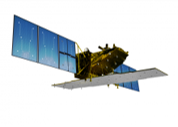
▲Land Observation Satellite 2 “Daichi-2” (ALOS-2) ©JAXA
②Verification of Emission Calculation Mechanism
We will implement the methane gas emission calculation mechanism using satellite data in Bulacan Province, Philippines. The existing methane gas emission calculation system*4 required weekly on-site measurements, but the satellite data-based calculation method can reduce on-site measurements, providing more objective data. By utilizing this mechanism, we aim for efficient and objective carbon credit generation overseas.
◆Introduction to JAXA ALOS-2 Commercialization Demonstration
The JAXA ALOS-2 commercialization demonstration*5 aims to demonstrate the feasibility of businesses using archive data from the Land Observation Satellite 2 (ALOS-2), which has been ongoing since the fiscal year 2021. The future outlook includes promoting the commercialization of satellite data through private initiatives.
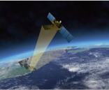
▲Observation image of Synthetic Aperture Radar (SAR) on ALOS-2 ©JAXA
*1: This is a system where the country certifies the reduction of CO2 emissions through the introduction of energy-saving facilities, the use of renewable energy, and the absorption of CO2 through appropriate forest management as “J-Credits.” This system is a comprehensive integration of domestic credit systems and offset credits (J-VER) and is operated by the government. J-Credits created through this system can be utilized for various purposes, such as achieving the goals of the Keidanren Carbon Neutral Action Plan and carbon offsetting.
*2: A new methodology for methane gas reduction and J-Credit generation through the extension of mid-drying periods has been approved in the J-Credit system. Mid-drying (falling water) in paddy fields reduces methane gas emissions by suppressing the activity of anaerobic bacteria when soil and air come into contact.
*3: The Rice Farming Consortium was established to support the creation activities of rice farmers under the J-Credit system “Extension of Mid-Drying Period in Paddy Cultivation.”
*4: The calculation mechanism AMS-III.AU, used by certification bodies such as CDM (Clean Development Mechanism), VCS (Verified Carbon Standard), Gold Standard, etc., focuses on methane gas emission reduction through adjusted water management practices in rice cultivation.
*5: The JAXA ALOS-2 Commercialization Demonstration utilizes observation data (archive data) from the Synthetic Aperture Radar (SAR) installed on ALOS-2, launched in 2014, for nine years. This project aims to demonstrate the potential for regular use leading to commercialization.